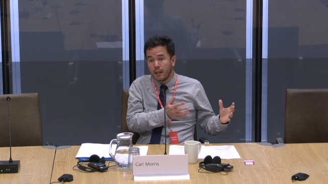
Today I had an opportunity to present evidence to a Senedd committee for the first time.
It was a great experience in many ways, and I was very happy to discuss technology and the Welsh language.
Today I had an opportunity to present evidence to a Senedd committee for the first time.
It was a great experience in many ways, and I was very happy to discuss technology and the Welsh language.
Here’s an enlightening blog post by Ben Proctor my co-member of the Mapio Cymru project team, all about street name data from Ordnance Survey. This should be of huge interest to anybody who contributes to OpenStreetMap:
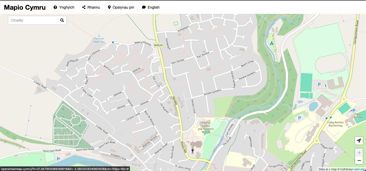
A key objective of the Mapio Cymru project is to help increase the amount of names in Cymraeg (Welsh language) held by OpenStreetMap as open data, as a resource to support mapping apps and services available in Cymraeg in the future.
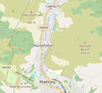
The biggest single gap in name data in OpenStreetMap in Cymru (Wales) is road names that should be used in Cymraeg.
[…]
Through analysing the data available in the OS Open Roads product Ben has reached the conclusion that as a data set it’s good enough to use:
[…]
Having broken down these various differences we concluded that the OS Open Roads dataset is a good enough source for human editing. An editor reasonably familiar with road names in Cymraeg would be able to detect many of the problems and resolve them correctly.
[…]
I had a lot of fun taking part in a history hackathon event, Hacathon Hanes 2025, at the National Library, Aberystwyth on 12 February this year.
There were loads of datasets and resources available to hack and adapt and then create. I decided to combine some of my interests in a one-day project – the history of campaigning, peace, data, and mapping.
In the year 1923 following the horrors of the Great War there was a great effort to organise a peace petition. Ultimately 390,296 signatures were collected from women in Wales, approximately one third of all the women and girls in Wales at the time. Superb! The petition then went on quite a journey. You can read the history.
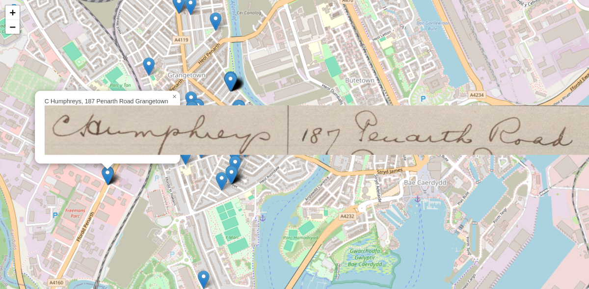
Here’s a (very very early) prototype of a contemporary map showing petition signatures from women in the Grangetown area of Cardiff.
The map is an effort to:
The location data and images come from the Welsh Women’s Peace Petition digitisation project by the library itself and its crew of volunteers.

As a result I’m already seeing my local streets in a different way.
The main technical challenges for me were tidying the data and ensuring consistency, and finding the map locations. In the data each address was in a single field and there was a bit of inconsistency (which reflected the variation in the original documents, to be fair). I extracted the street names with a script and some editing by hand. I used the open data set OS Open Names to get coordinates for the centre of each street (rather than something like the Google Maps API which I believe has restrictions on use). The OS data set offers the location of the middle of the street and a ‘box’ around the street.
Of course my map needs a lot more signatures. There are only 69 in total on the current version. It will be good to be able to extend to the whole city and the whole country of Wales afterwards. I no longer have access to the original data.
I also need a better way to show a cluster of signatures that have come from the same street as well, possibly by using the data for the box around each street. At the moment there’s a bit of random variation in the locations for each street, to prevent them overlapping – this was a quick temporary fix.
Hopefully the project can be updated in the near future. I’d also like to share the code behind it.
Thanks to the Library for the welcome. Here is an article by Jason Evans which includes mention of some of the other projects.
The aim of the Mapio Cymru project is to improve the next generation of Welsh-language mapping services, and for me it’s been among the best work projects ever for learning new things – about open data, GIS, a dev skills.
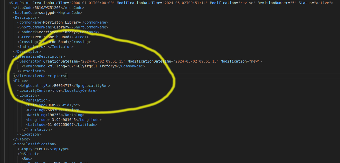
On the project blog I wrote a post about changes to NaPTAN which is a big list of transport points including bus stops and railway stations.
This is a test item. I am looking at the ActivityPub feed of this blog, which enables you to follow my posts using Mastodon and other services.
As part of my work on the Mapio Cymru project I’ve provisioned a new experimental map server.
Like the main map it shows a map with place names in Welsh. The difference now is that it provides a symbol next to every place name to show which data source was used. This should help anybody who wants to contribute place names in Welsh, participate in the project, and ultimately improve mapping in the Welsh language.
This is a mix of electronic music recorded on 28th July 2022, entitled Peiriant Breuddwydio 1.
It was inspired by the Dreamachine experience in Cardiff.
Dychmygwch realiti gwahanol. / Imagine a different reality.
As a freelance web developer I always enjoy working on Mapio Cymru, and it’s an opportunity to bring together some of my interests: free software, open data, maps, and the Welsh language.
The project has grown from the experimental map with names in Welsh. We are now helping a couple of organisations to offer mapping services in Welsh.
One of those organisations is Trafnidiaeth Cymru / Transport for Wales.
Here’s Ben Proctor from the project with some details of our consultancy work for TfW:
Transport for Wales asked us to undertake a piece of research for them. They wanted to know how they could build online mapping applications that treated Welsh and English language equally.
We’ve been thinking about these issues for several years and we maintain a Welsh language map of Wales at openstreetmap.cymru This, however, was a real opportunity to think about these questions from an organisation providing public transport services across Wales. We’ve produced a report for Transport for Wales which has a lot of detail in it and is very focused on their specific circumstances. […]
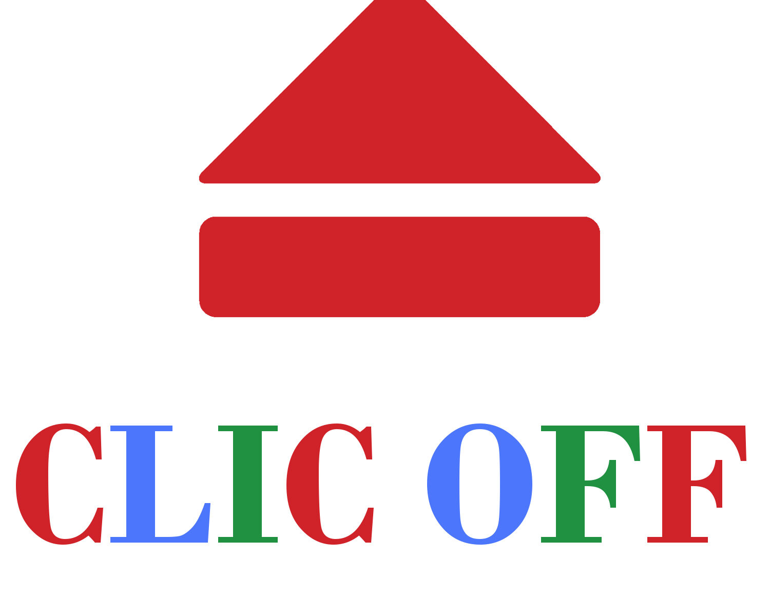
I made a new Twitter bot called Clic Off which just started today.
It automatically tweets selections of TV programmes on the Welsh-language channel S4C. What the shared programmes have in common is that they’re about to disappear from the service because they’ve almost reached their full term. The bot gives you a last chance to watch.
Here’s an example:
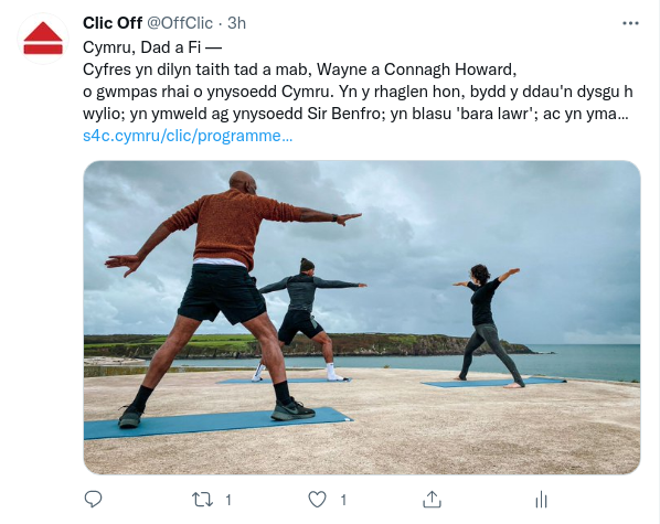
I am a fan of S4C and the bot is entirely unofficial.
One of the most interesting elements was the algorithmic tweaking to try to get a representative balance of programmes. It turns out that a completely random pick of available ‘last chance’ programmes results in a surfeit of childrens’ programmes.
Do you want to discuss having a bot for your project or use of data, code, and automation to solve problems and take opportunities? Feel free to contact me.
From a Welsh perspective there is a clear problem of inaccuracy when the media in London reports stories about devolved matters.
For example in a story about education or health in England the papers, television or radio incorrectly refer to the United Kingdom or fail to refer to any country whatsoever. Or there is a lack of attention to the vitally important differences in legislation and policy between Scotland, Wales, Northern Ireland, and England.
This of course can lead to confusion, and lack of awareness of where powers are held and who is accountable. Despite the efforts of media who focus on Wales matters there’s a significant percentage of people in Wales who receive this misleading news, typically from London outlets.
The That’s Devolved project consistently highlights examples. There are some instances where the journalists and editors have corrected headlines and stories as a result. From a devolution perspective it works well. Many onlookers have learned more about the powers of the Welsh Parliament, the Scottish Parliament, and Stormont through the efforts of the project.
A while back I was thinking of the journalists’ own perspective. I had some enlightening conversations with experts and friends about this. Can a campaign or resource be created to be used in response to these journalists, and help change attitudes?
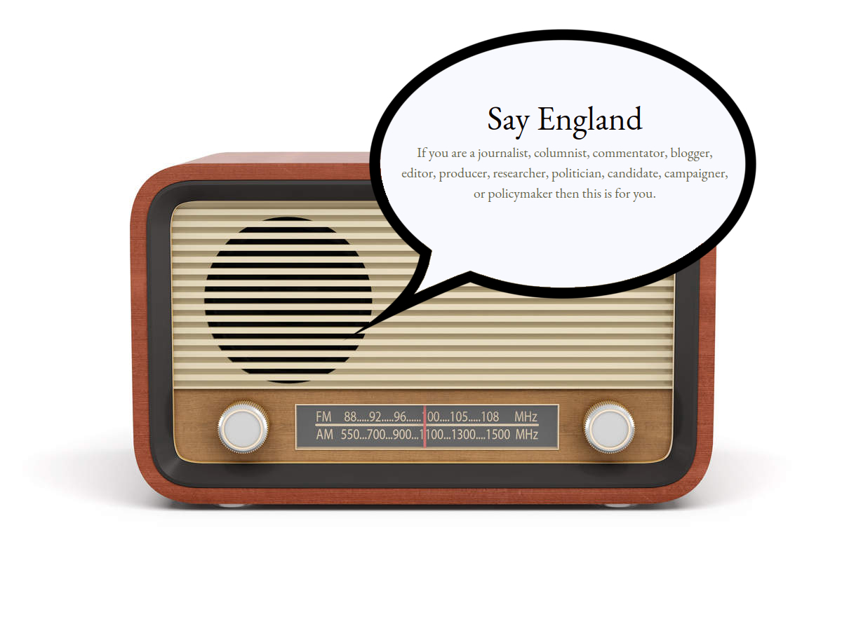
The result was a website I created called Say England.
The rationale was to convey the problem from a perspective that most English journalists understand – the English perspective.
It seemed more difficult to persuade them to care about Wales or that ‘devolution’ is worth trying to understand. (The few who do pay attention are very special.)
Currently the website is a single page listing some advice for journalists and others. It can be posted in replies on social media all day long.
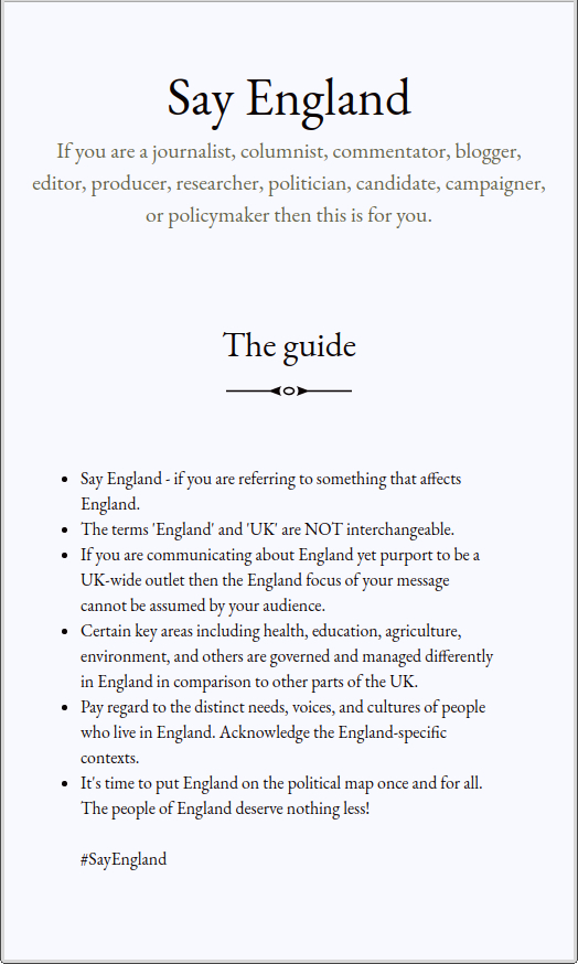
It names other roles involved in the media narratives who get this wrong – for many different reasons.
Unfortunately the Say England website is a project that has not been completed or launched. For one thing I am a dad now and there are plenty of other ongoing projects and commitments – this one doesn’t easily fit with the others.
You may see its potential perhaps using the site as a rallying point for shareable content, campaigns, updates on progress, lists of good, bad and ugly, or something else.
I would consider giving the domain name to anyone principled and enthusiastic who wants to take it on, use it, and develop it.
Please let me know in the comments below or by email if you want to take over the project.